Collective Fieldwork
Systematic land use surveys, environmental monitoring, health assessments, and service access studies through collaborative fieldwork with residents.
Land Use Change and Land Markets Surveys
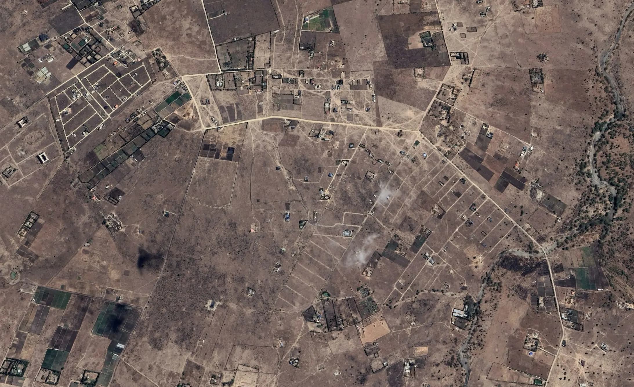
Initiation of the Land Use Change and land markets Surveys (Lead Dr. Bérénice Bon, geographer). Longitudinal analysis of land markets. Kitengela is a small town that is rapidly growing both demographically and spatially, and that is attracting both Nairobi residents and inhabitants of nearby towns and villages. When the country gained independence, the land surrounding Kitengela was allocated to the Maasai community, who formed Ranches - management groups - to govern it. Currently, all Maasai families possess individual private land titles, the result of a process of gradual land fragmentation that began in the 1980s.
We conduct in-depth, long-term interviews within the peri-urban study sites to analyze the evolution of land markets over time. After identifying the main drivers and actors involved, we examine these areas through the lens of the formalization of land rights. This process has progressively individualized relationships to land, increased its market value, and contributed to socially selective dynamics. It has also fueled intense resale activity in the form of small residential plots.
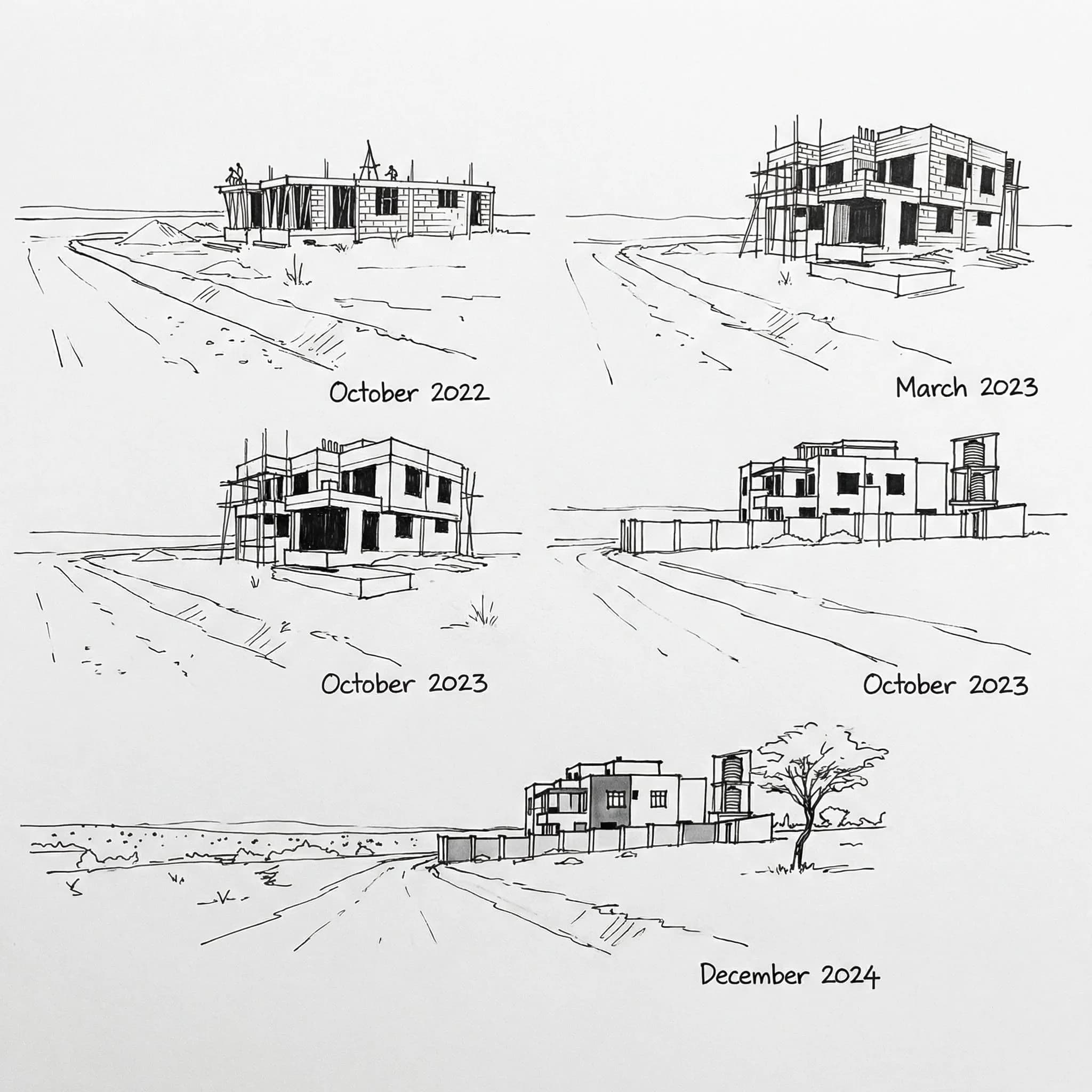
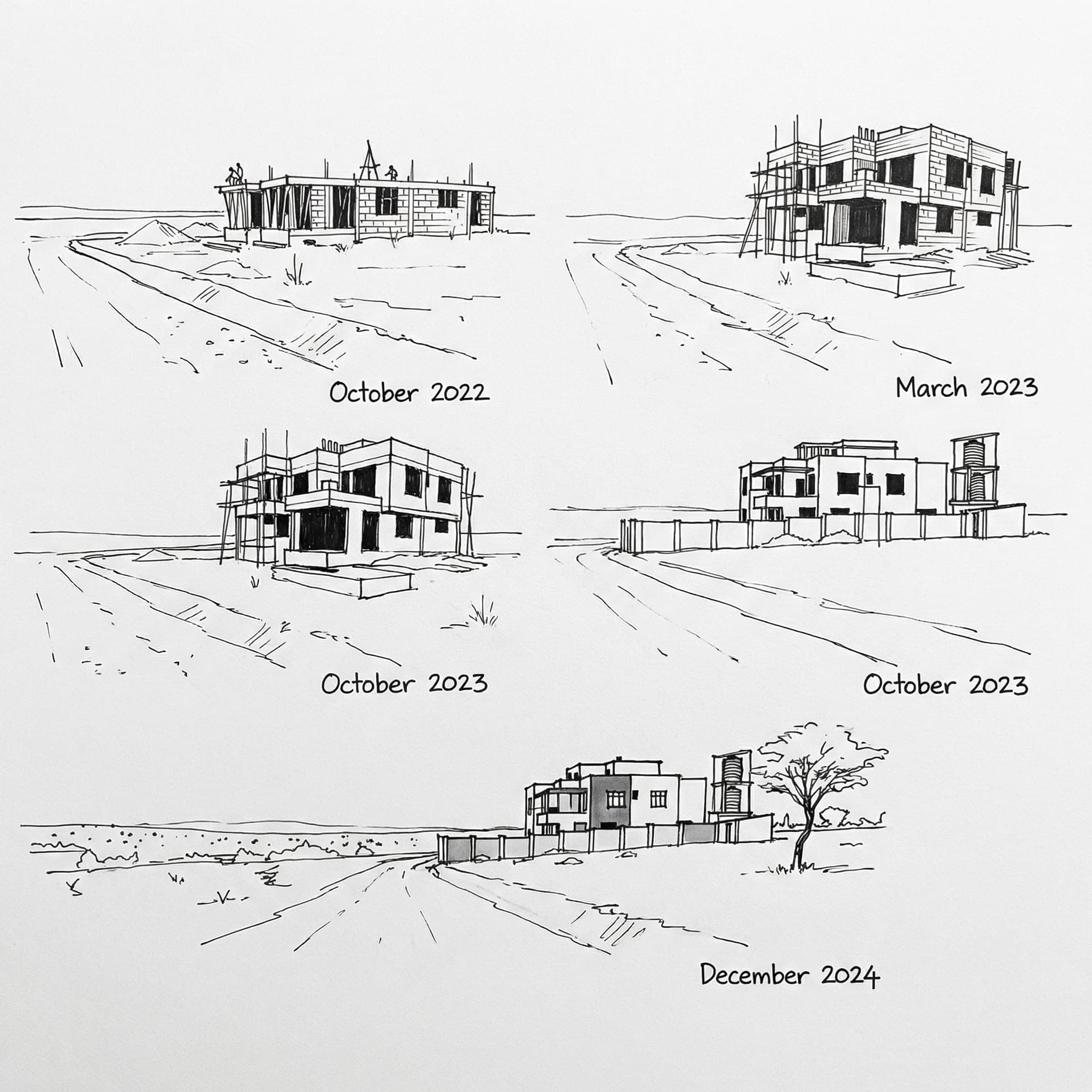
This transformation is visible on the ground through systematic marking of future subdivisions: pegs, beacons, live fences, and concrete block walls increasingly replace isolated trees and symbolic markers that previously defined customary communal land rights.
Our objective is to better understand the choices, strategies, and constraints shaping these peri-urban land markets. The research focuses on three interrelated dimensions of change:
• Changes in property ownership – the shift toward more individualized land rights and the gradual registration of titles, calling for a sociological understanding of property and tenure transitions. • Changes in land use – the economic valorization of land through self-construction, real-estate promotion, or, conversely, its withdrawal from agriculture without immediate construction, resulting in long-term fallow plots. • Changes in land size and configuration – the fragmentation of rural holdings into smaller residential parcels that often enter chains of transactions before being built upon.
Upstream, we examine the redistribution of customary land rights, the individualization of ownership through "mother titles," intra-family subdivisions, the factors driving land sales, and the reinvestment of land proceeds. At the intermediate stage, we analyze the division of mother titles, sources of capital, plot-level investments, and links with commercial activities. Downstream, we focus on plot sales, sources of capital mobilized by buyers, investments on plots, and investments in infrastructure and services.